Vima Brosta · Surveillance & Privacy Lab · Program 01

Drive
around them.

Offlock is a navigation instrument that plans your route around the license-plate readers mapped across the US and Canada. It computes on your phone, shows you every request it makes, and never asks who you are. Launching on iOS in late 2026.

0plate readers on this map
2,700+speed & red-light cameras
40 mdetection corridor

Every dot is a reader mapped in OpenStreetMap by the DeFlock community, September 2026. Coverage is only as complete as the map.

The lab

Instruments for a watched city.

The Vima Brosta Surveillance & Privacy Lab studies how automated surveillance is built, bought and searched, and builds instruments that hand a measurable share of the street back to the person on it. Offlock is the lab's applied program: three lines of work, one product name.

Program 01Field testing

Navigation

Surveillance-aware routing on OpenStreetMap. Every mapped reader, which way it faces, and a route that prices it honestly against your time. Computed on the phone inside downloaded regions.

Offlock for iOSThe instrument →
Program 02In development

Textiles

S01: a palette-locked camouflage computed against the person detectors behind video search. Two colourways, Night and Fog, scored on detectors they were never tuned on.

Offlock S01The pattern →
Program 03Coming soon

Resilience

Off-Grid: whole regions on the phone. The map, the routes and the readers, downloaded before you need them, for the day the signal goes dark.

Offlock Off-GridThe pack →

Position

Not another camera map.

Maps of plate readers already exist, and they matter. DeFlock and thousands of OpenStreetMap contributors put the readers on the map; the lab's contribution starts where the map ends.

A map tells you where the cameras are. An instrument changes what you do about them. Offlock treats each reader as a cost with a direction, prices it against your time in the open, and lets you pick the trade. It never claims a route is clean, because the map is never complete. It shows the counts it can stand behind.

The same discipline runs through everything the lab publishes. Every film cites its sources on screen. Every S01 number says which detectors it was scored on and at what distance. Every network request the app makes is listed inside the app.

Who mounts them

Where OpenStreetMap records an operator, the largest fleets of mapped readers are retail, not police.

Lowe’s1,708
The Home Depot1,105
San Diego Police Dept.535
Detroit Police Dept.435
California Highway Patrol400

Operators as recorded in OpenStreetMap, September 2026. Most readers have no operator recorded.

What the instrument does that a map can't
01Models the directionA reader counts only if it sits within 40 m of your route and, when its facing is mapped, points along that road. Only the watched road is closed to the router, never the cross street.
02Prices the tradeEvery candidate is ranked by travel time plus a cost per reader. You see the delta on each option: “+3 min · 2 fewer readers”. The fastest route is always offered.
03Computes on the phoneInside a downloaded region the whole route is planned on the device by an embedded engine. No routing request leaves it.
04Writes a receiptAfter every guided trip: readers passed against the fastest route, plus a weekly total. Counts only, on the device, gone after six months.
05Shows its own trafficEvery request the app makes, with its exact URL and body, is listed in Settings → Privacy. There are no accounts, no ad SDKs and no location history.
06Gives back to the mapLong-press where a reader stands and publish it to OpenStreetMap under your own account, with DeFlock's tags. The next driver benefits.
Interactive · Real roads, real readers

Pick two places. See what your GPS won't show you.

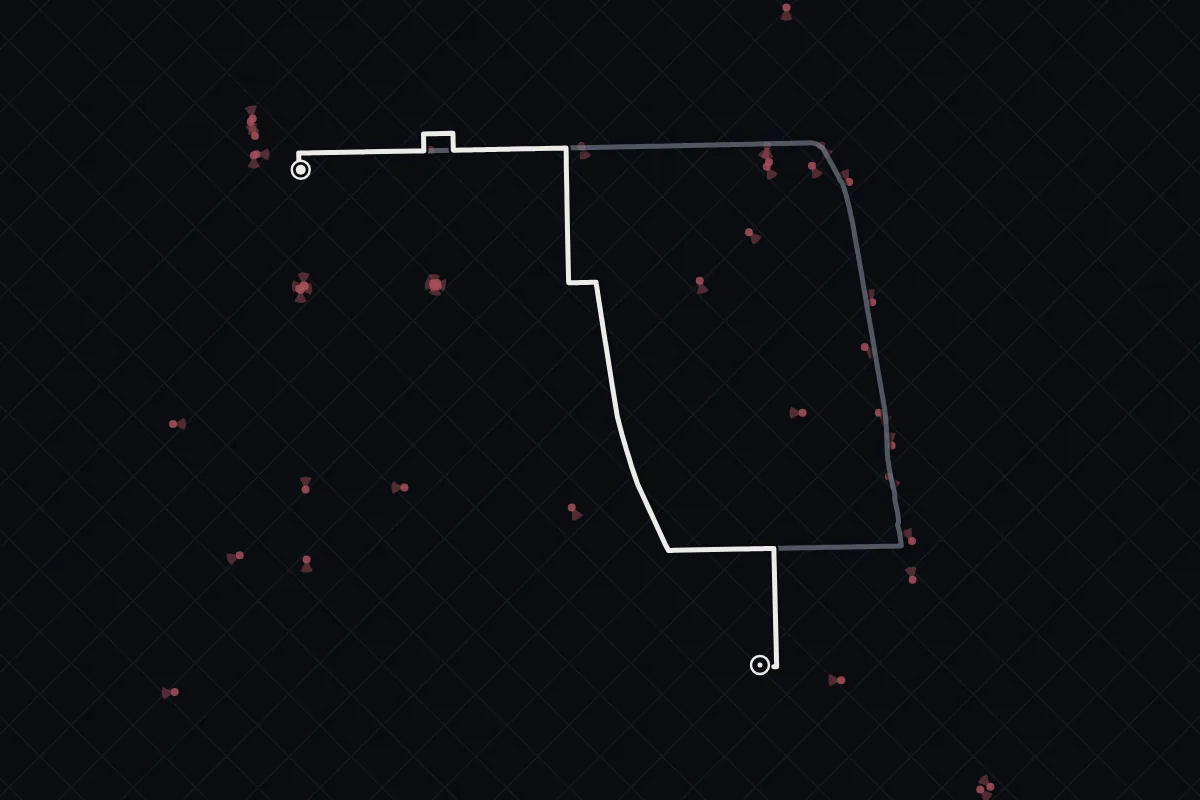
Any two addresses in the US or Canada. The fastest route is what an ordinary GPS gives you. Offlock prices every mapped reader on the way and offers the trade, first Balanced, then Strict. Same router, same map data as the app.

Try

Drag the pins to move them. Click the map to set the destination; shift-click for the start.

Counts include only readers mapped in OpenStreetMap, within 40 m of the road and, when the facing is mapped, pointed along it. Coverage is only as complete as the map. No live traffic.

Live map

Loads street tiles from OpenFreeMap when you start. That's the only request this site ever makes to anyone else, and it carries no address: just the tiles you look at.

How it counts40 m from the road, facing respected. A reader with a mapped facing only counts for the road it watches, in either direction. Unknown facing counts everywhere.
How it re-plansUp to three more asks. The readers the cheapest route actually passes are closed to the router, watched road only, and it is asked again with alternates.
What's different from the appNothing in the counting rule. The app does this on the phone inside downloaded regions; here your two addresses go to our server, which asks the router for you. The demo closes roads within 20 m of a passed reader; the app closes the exact road edge it sits on.

Method

How a route is planned.

The engine is Valhalla, the open router that runs on OpenStreetMap. Offlock adds a planner on top that treats surveillance as a generalized cost. Five steps, the same on the server and on the phone.

Fastest first

Valhalla computes the fastest route and up to two alternates, with your toll, highway, ferry and unpaved preferences.

Count the readers

The on-device dataset is scanned along each corridor. A reader counts if it is within 40 m of the route and, when its facing is known, pointed along that road.

Ask again, without them

The router is asked for new routes with those specific readers excluded. For directional readers only the watched road is closed. This repeats a few times.

Rank the trade

Every candidate is scored by travel time plus λ per reader passed, under a detour cap. The fastest route always stays on the list.

Say what you know

Each option shows its computed deltas. Labels like “Fewest readers” appear only when the data supports them, and no route is ever called clean.

score = travel time + λ × readers passed
Balanced defaultλ = 2 min per reader · detour cap 1.4× the fastest time
Strictλ = 8 min per reader · detour cap 2×
Offλ = 0 · readers shown and announced, never avoided

Camera data reaches routing through one audited adapter, and only when avoidance is on. The map overlay is informational and cannot influence routes. Driving behaviour never influences routes either. Architecture tests enforce these boundaries.

What we claim

  • Routes are ranked against the license-plate readers mapped in OpenStreetMap, with facing taken into account where it is recorded.
  • Inside a downloaded region, routing happens on the phone and no routing request leaves it.
  • The app has no account, no advertising or tracking SDK, and stores no location history. A test in the codebase fails the build if a tracking SDK is added.
  • Speed and red-light cameras are shown and announced ahead on the route.

What we don't

  • That any route is free of cameras. Coverage is only as complete as the map, and the app says so.
  • That speed or red-light cameras are avoided. They never change a route.
  • That unmapped, private or mobile readers are counted. Only what OpenStreetMap knows is priced.
  • That a shorter count is anonymity. It is fewer scans, which is all it is.

Program 01 · The instrument

A navigation app that reads like a receipt.

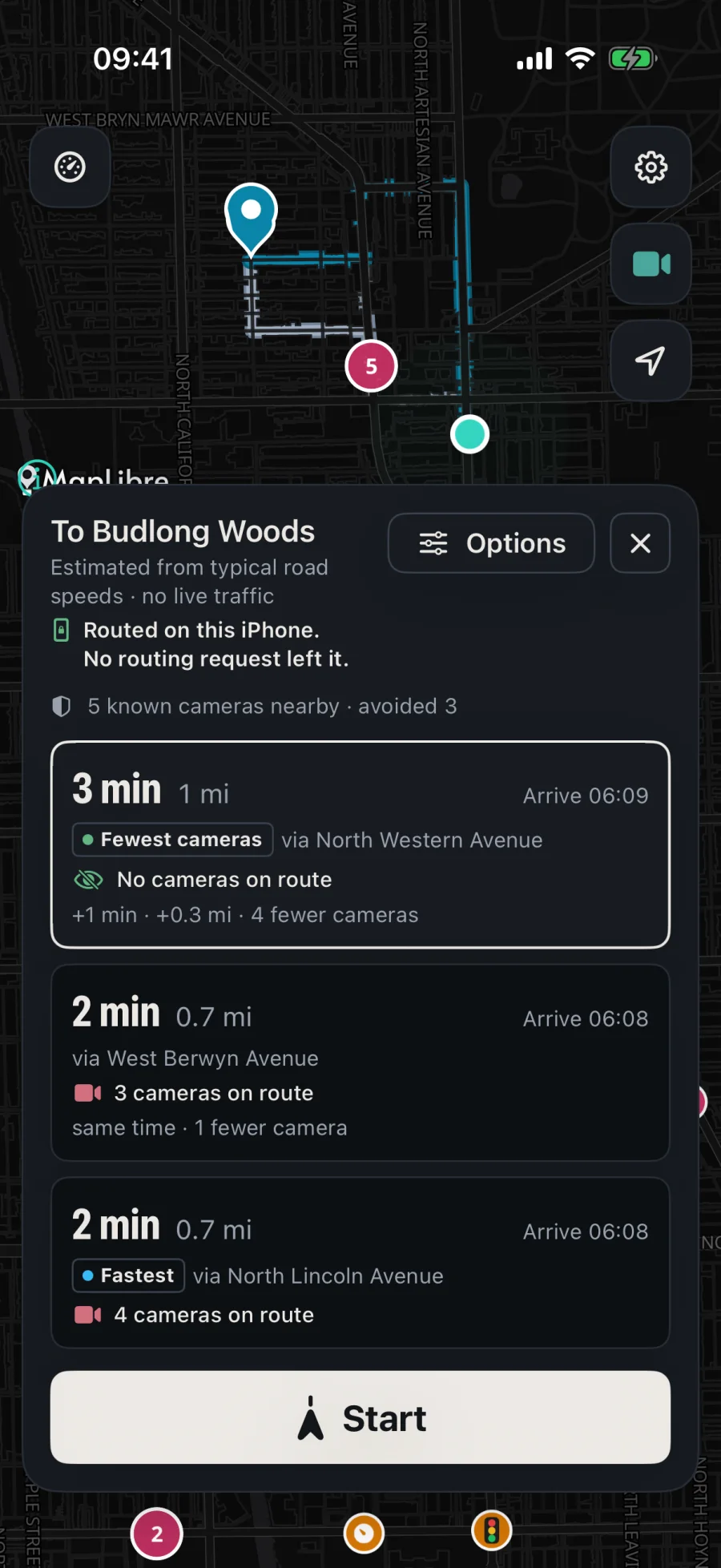
Search, alternates, turn-by-turn guidance, rerouting, speed limits, CarPlay in testing. And on every screen, the number the others don't print: how many readers this trip passes.

Offlock route preview to Budlong Woods showing three options; the first says No cameras on route, +1 min, 4 fewer cameras
Route preview

The trade, in the open

Three routes, each with its time, distance and reader count. “Routed on this iPhone. No routing request left it.”

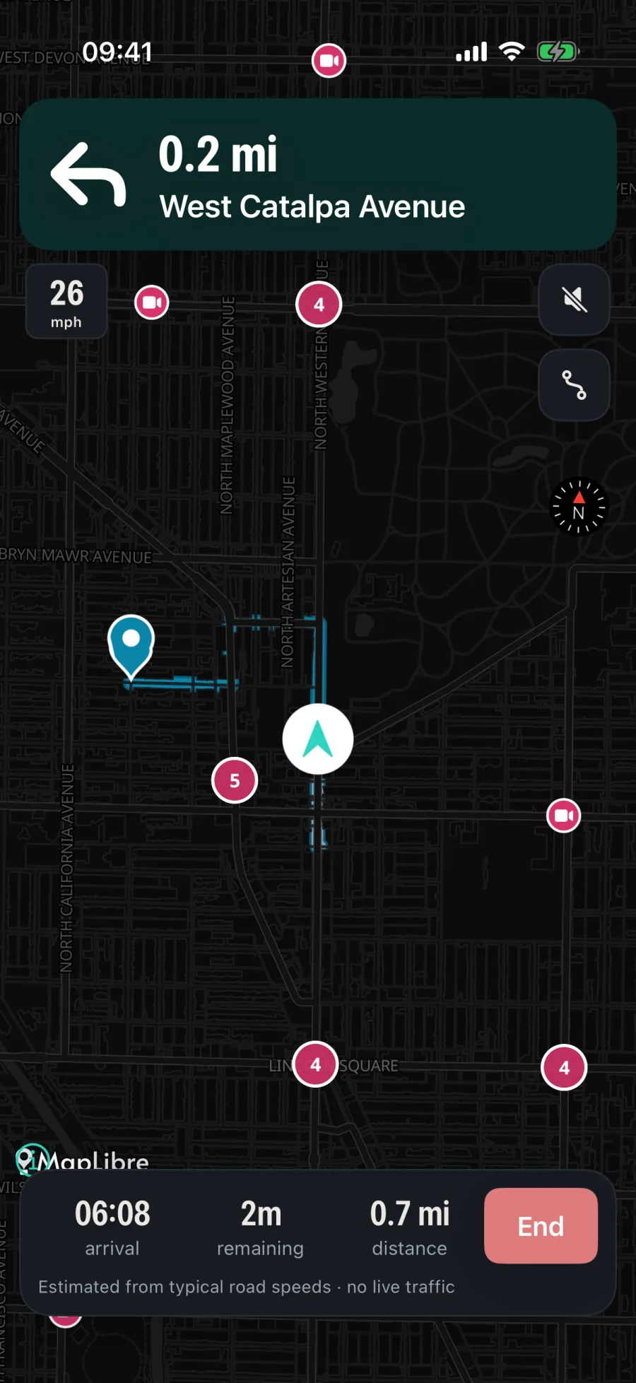
Offlock turn-by-turn guidance screen
Guidance

Turn by turn, on device

Maneuvers, speed limit, reader and enforcement alerts ahead, spoken guidance, background guidance and dead reckoning through tunnels.

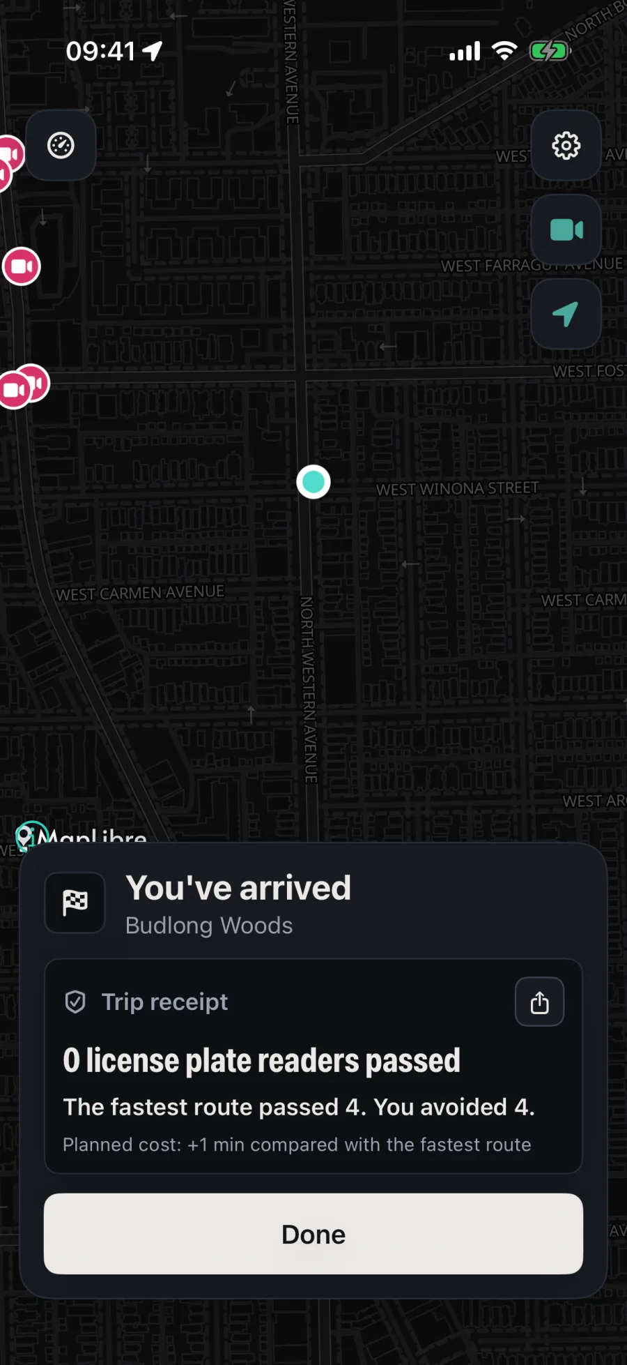
Offlock arrival screen with the trip receipt
Arrival

The receipt

Readers passed against the fastest route offered, and a weekly total. Counts only, kept on the device for six months, off with one switch.

FeatureWhat leaves the deviceWhere it goes
RoutingStart, destination, preferences and the readers to exclude. Nothing when the region is downloaded: the route is computed on the phone.Valhalla via the Offlock gateway, which never logs bodies or coordinates
SearchThe query text and your position rounded to about 1 km for ranking.Geocoder
Camera dataNothing about you. The whole national dataset is downloaded and every lookup happens on the device.Static file host
Driving ScoreNothing. Telemetry, events, trips and scores are computed and kept on the device.Nowhere
AnalyticsOff by default. If you opt in: event names and coarse buckets, never a location.A separate endpoint, separate connection
IdleNothing is sent while the app is in the background, and GPS turns off unless guidance is active.—

#mALPRactice · Findings

Thirty-five short films. Every claim sourced on screen.

The lab publishes its findings as vertical films built from reporting, court records, procurement documents and vendors' own materials. Each card cites its source. The on-screen text in every film is in the app's own words: no route is ever called clean.

Films are 9:16 and load only when you press play. Camera data in every film © OpenStreetMap contributors, mapped by the DeFlock community.

Program 02 · Textiles · S01

Computed against the software that finds people in video.

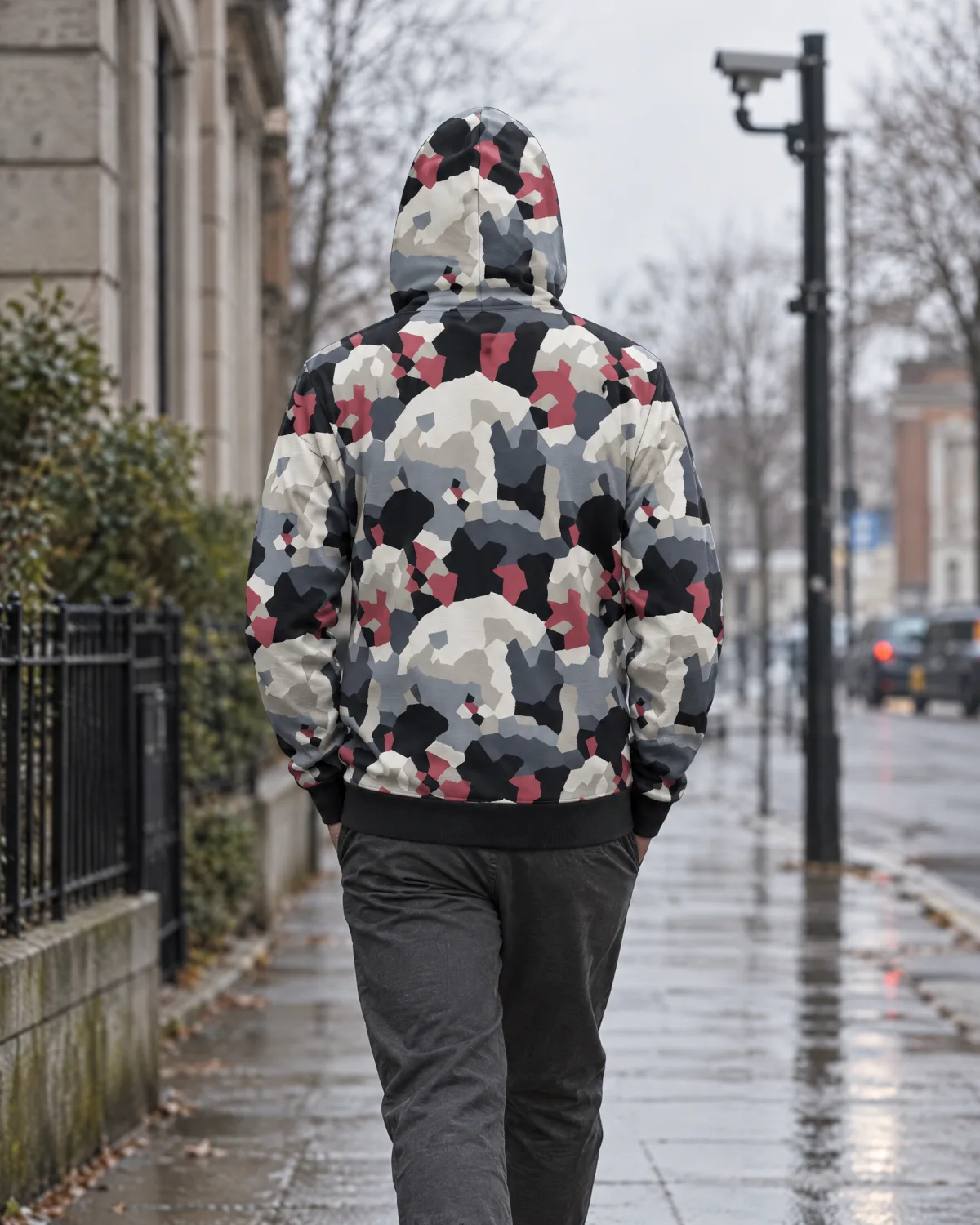
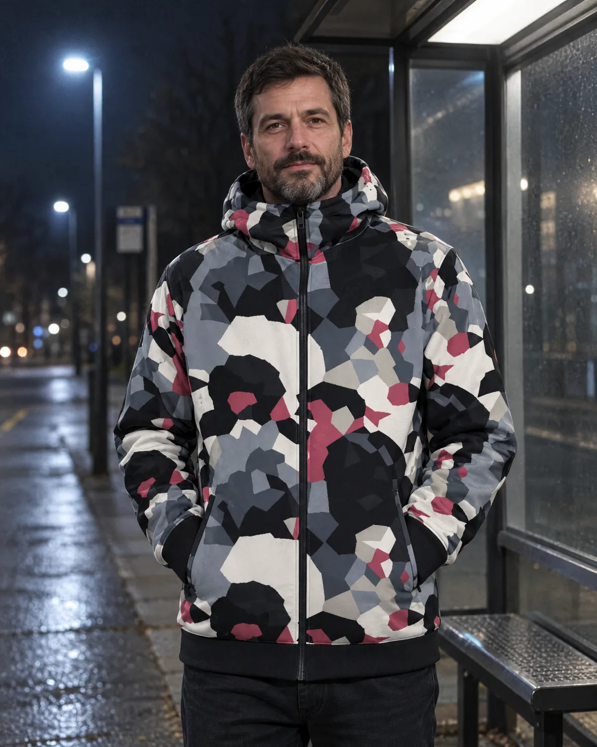
Police searched Flock's video tools for people by clothing, not by plate. Other vendors sell the same search. S01 is a two-scale Voronoi camouflage, optimized on real pedestrian photos against three person detectors, with a fixed palette so it prints and still looks like clothing.

How the pattern is made

Fourteen macro regions of about 10 cm, for wide-angle cameras at 10 to 20 m, over 180 cells of about 2.7 cm. Each cell takes one ink from a locked palette. The tile is rendered onto the torsos of real pedestrians with the photo's shading kept, under random scale, rotation, foreshortening, fabric warp, lighting, occlusion, blur and distance, and the detectors are asked to find the person.

A third of the renders use a simulated 850 nm night view, which is why the palette carries two near-identical darks: a carbon black that stays dark to infrared and a graphite that goes bright. Colour caps keep any one “upper clothing colour” under 42% of the tile, because attribute search bins by colour.

Night
Fog
Night · 850 nm

What it is, and isn't

It won't make you invisible. Nothing will. S01 is designed to make you harder to pick out by software, on the detectors it was scored against, at the distances we tested. It is not a face covering, and the hoods stop at the chin. Distinctive prints can make attribute search easier, and we say so.

I want one when it ships

S01 Night
58%
S01 Fog
61%
Scrambled-ink control
95%
Ordinary clothes
99%
Share of rendered test images in which detectors not used in tuning found the wearer, at about 6 m, score ≥ 0.25. Lower is better. Simulated 850 nm night: about 80%. Digital tests only. Physical tests on fabric and people are the next step, and no public claim will go beyond them.
The line, first run
H01Hooded top · FogEdge-to-edge print, front, back and sleeves. Tonal chest badge. Hood zip stops at the chin.
H02Hooded top · NightCarbon-black darks for infrared, pigment-printed so the black stays black.
T01 / T02Tees · Night and FogSame tile, same coverage rule. Coverage, not cleverness, is what the research says drives the effect.

Program 03 · Resilience · Off-Grid

For the day the signal goes dark.

GPS comes from satellites, not cell towers. Offlock already plans routes on the phone for downloaded regions. Off-Grid packs put the whole region there: the map, the routes and the readers, downloaded before you need them.

74%of cell sites down in North Carolina's affected counties after Hurricane Helene, 28 Sep 2024. Power loss was the leading cause.FCC DIRS
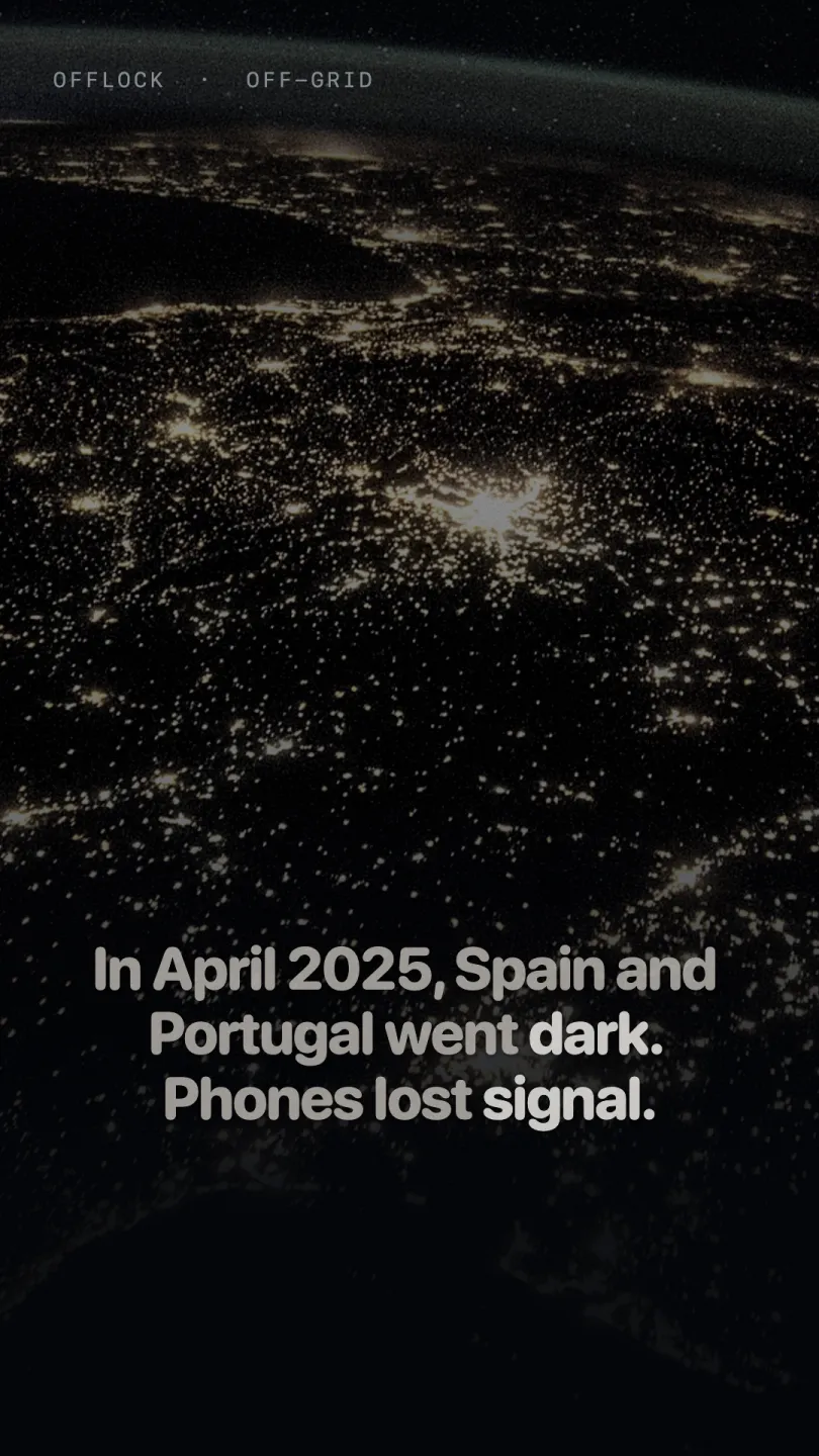
50M+people lost power in Spain and Portugal on 28 Apr 2025. Mobile networks degraded over hours as base-station batteries ran out.ENTSO-E · ANACOM
×2Data-centre electricity use is projected to roughly double by 2030, from 485 TWh in 2025. A projection, with the strain local.IEA, Apr 2026

Works today: routing on the phone inside downloaded regions, with the same reader avoidance and nothing sent to a server. In development: offline map display, region downloads and an on-device search index, packaged as the Off-Grid tier.

Tell me when packs ship

Roadmap

Where this is going.

Dates are targets, not promises. Subscribers hear first when one moves, in either direction.

NowField testing

Chicago field tests

The routing engine, guidance and receipts run daily on real streets. The camera dataset of every mapped US and Canada reader is rebuilt nightly from OpenStreetMap and DeFlock.

  • On-device routing inside downloaded regions
  • Directional reader model, trip receipts, destination check
  • Network activity log, no account, no tracking SDK
Q4 2026Planned

Private beta on TestFlight

A small cohort of drivers in a few US cities. Subscribers are invited in the order they signed up.

Late 2026Launch

Offlock for iOS, on the App Store

Free. No account. US and Canada reader coverage from day one, with camera-aware routing, guidance and receipts.

Early 2027In development

CarPlay

Search, trip preview with reader counts, guidance, camera alerts and the arrival receipt already run in the Simulator. Waiting on Apple's navigation entitlement and head-unit testing.

2027In development

S01 apparel, first run

Physical camera tests on fabric and people come first: 850 nm swatch tests, walk-bys at 5 to 20 m, on detectors the pattern was never tuned on. Then a limited run of H01, H02, T01 and T02.

2027In development

Off-Grid packs

Offline map display, region downloads with routing tiles and readers, and an on-device search index. Routing on the phone already works; the pack makes it whole.

Under studyResearch

On foot, and beyond iOS

Surveillance-aware walking routes are in design. Android is not yet scheduled; tell us below if that's what you're waiting for, and it will count.